File:Gran_Rio_&_Pikin_Rio.png
From Wikipedia, the free encyclopedia
Gran_Rio_&_Pikin_Rio.png (161 × 117 pixels, file size: 2 KB, MIME type: image/png)
| This is a file from the Wikimedia Commons. Information from its description page there is shown below. Commons is a freely licensed media file repository. You can help. |
Summary
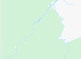
| DescriptionGran Rio & Pikin Rio.png |
Nederlands: Boven-Surinamerivier, inclusief de benedenloop van de Gran Rio en Pikin Rio
English: Upper-Suriname River, including downstream Gran Rio and Pikin Rio |
|||||||||||||||
| Date | ||||||||||||||||
| Source | www.openstreetmap.org, 4.565 North, -55.62 West -55.28 East -3.84 South | |||||||||||||||
| Author | OpenStreetMap contributors | |||||||||||||||
| Permission (Reusing this file) |
|
|||||||||||||||
| Other versions |
|

Captions
Items portrayed in this file
depicts
image/png
1,866 byte
117 pixel
161 pixel
da2f4d128116be29d8d7ab61705fa66413dc1e8c
File history
Click on a date/time to view the file as it appeared at that time.
| Date/Time | Thumbnail | Dimensions | User | Comment | |
|---|---|---|---|---|---|
| current | 15:30, 24 June 2023 | | 161 × 117 (2 KB) | Ymnes | File:Boven-Surinamerivier, met Gran en Pikin Rio.png cropped 45 % horizontally, 78 % vertically using CropTool with precise mode. |
File usage
Metadata
This file contains additional information, probably added from the digital camera or scanner used to create or digitize it.
If the file has been modified from its original state, some details may not fully reflect the modified file.
| Horizontal resolution | 37.8 dpc |
|---|---|
| Vertical resolution | 37.8 dpc |
| File change date and time | 15:28, 24 June 2023 |