File:GirondePays.png
From Wikipedia, the free encyclopedia
Size of this preview: 600 × 600 pixels. Other resolutions: 240 × 240 pixels | 480 × 480 pixels | 768 × 768 pixels | 1,024 × 1,024 pixels | 2,139 × 2,139 pixels.
Original file (2,139 × 2,139 pixels, file size: 559 KB, MIME type: image/png)
| This is a file from the Wikimedia Commons. Information from its description page there is shown below. Commons is a freely licensed media file repository. You can help. |
Summary
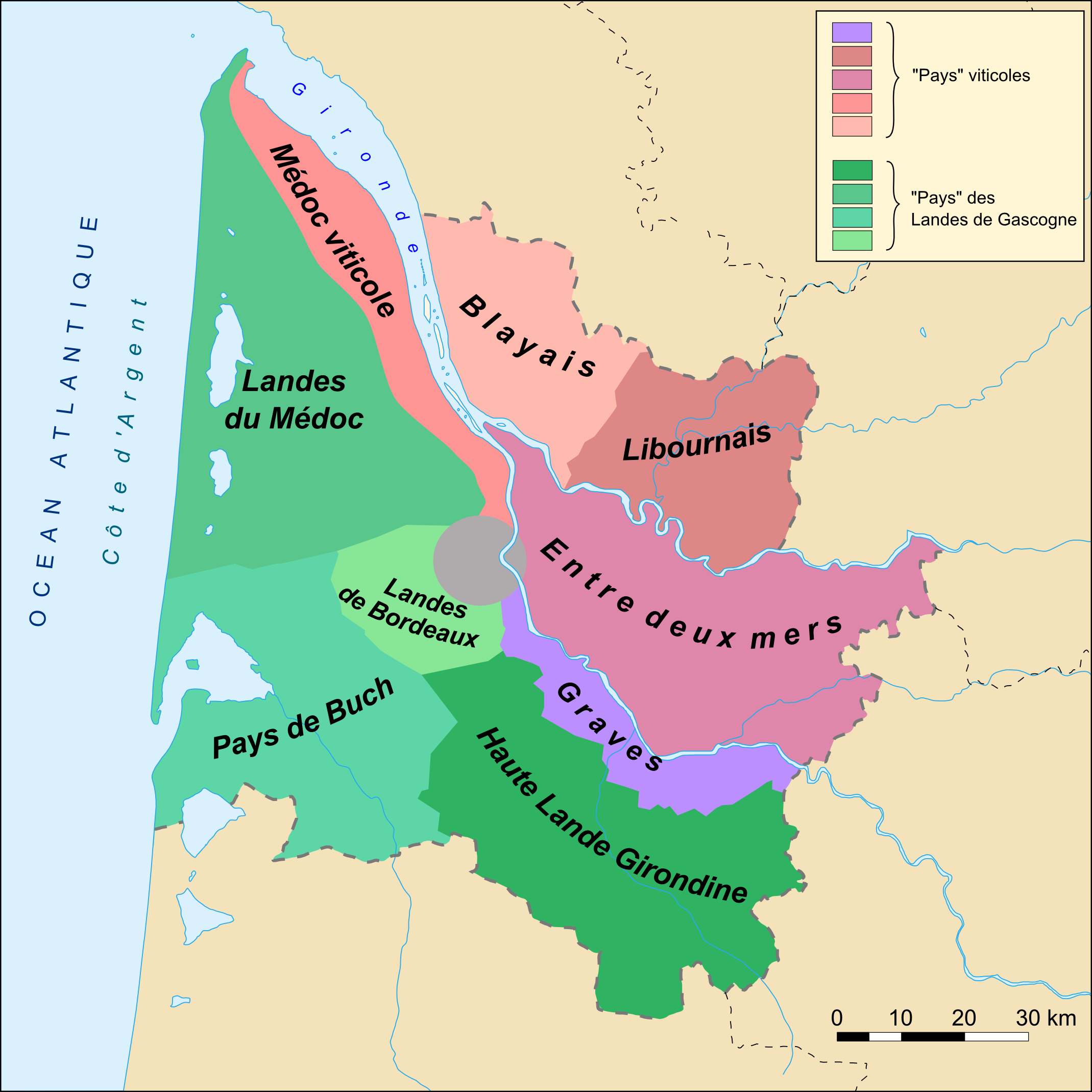
Carte des "pays" du département de la Gironde (33)
Catégory
Licensing
This file is licensed under the Creative Commons Attribution-Share Alike 2.5 Generic license.
- You are free:
- to share – to copy, distribute and transmit the work
- to remix – to adapt the work
- Under the following conditions:
- attribution – You must give appropriate credit, provide a link to the license, and indicate if changes were made. You may do so in any reasonable manner, but not in any way that suggests the licensor endorses you or your use.
- share alike – If you remix, transform, or build upon the material, you must distribute your contributions under the same or compatible license as the original.
Captions
Add a one-line explanation of what this file represents
Items portrayed in this file
depicts
File history
Click on a date/time to view the file as it appeared at that time.
| Date/Time | Thumbnail | Dimensions | User | Comment | |
|---|---|---|---|---|---|
| current | 20:15, 11 November 2007 | | 2,139 × 2,139 (559 KB) | Larrousiney | == Summary == Carte des "pays" du département de la Gironde (33) ==Catégory== Category:Maps of Gironde Category:Wines of Bordeaux Category:Landes de Gascogne == Licensing == {{cc-by-sa-2.5}} |
| 20:13, 11 November 2007 |  | 1,750 × 1,921 (441 KB) | Larrousiney | == Summary == Carte des "pays" du département de la Gironde (33) ==Catégory== Category:Maps of Gironde Category:Wines of Bordeaux Category:Landes de Gascogne == Licensing == {{cc-by-sa-2.5}} | |
| 23:54, 10 November 2007 |  | 2,139 × 2,139 (558 KB) | Larrousiney | == Summary == Carte des "pays" du département de la Gironde (33) ==Catégory== Category:Maps of Gironde Category:Wines of Bordeaux Category:Landes of Gascony == Licensing == {{cc-by-sa-2.5}} | |
| 22:50, 21 October 2006 |  | 1,750 × 1,921 (429 KB) | Mtu33260 | Carte des "pays" du département de la Gironde (33) ==Catégory== Category:Gironde |
File usage
The following pages on the English Wikipedia use this file (pages on other projects are not listed):
Global file usage
The following other wikis use this file:
- Usage on ast.wikipedia.org
- Usage on br.wikipedia.org
- Usage on ca.wikipedia.org
- Usage on cs.wikipedia.org
- Usage on da.wikipedia.org
- Usage on de.wikipedia.org
- Usage on en.wikivoyage.org
- Usage on eo.wikipedia.org
- Usage on es.wikipedia.org
- Usage on eu.wikipedia.org
- Usage on fi.wikipedia.org
- Usage on fr.wikipedia.org
- Gironde (département)
- Graves (AOC)
- Géographie de la Gironde
- Médoc
- Quinsac (Gironde)
- Bordelais (pays)
- Entre-deux-Mers
- Blayais
- Pays du Bassin d'Arcachon et du Val de l'Eyre
- Pays Gabay
- Pays du Libournais
- Cubzaguais
- Vignoble des Graves
- Pays du Cœur de l'Entre-deux-Mers
- Pays des Graves et Landes de Cernès
- Pays Médoc
- Pays de la Haute Gironde
- Vignoble du Libournais
- Vignoble de l'Entre-deux-Mers
- Graves-supérieures
- Libournais (région naturelle)
- Géologie du vignoble de Bordeaux
- Graves (région naturelle)
- Usage on fr.wikivoyage.org
View more global usage of this file.
Retrieved from "https://en.wikipedia.org/wiki/File:GirondePays.png"