File:Fort_of_Siwana_-_Barmer_-_Rajasthan_-_002.jpg
From Wikipedia, the free encyclopedia
Original file (4,160 × 3,120 pixels, file size: 4.64 MB, MIME type: image/jpeg)
| This is a file from the Wikimedia Commons. Information from its description page there is shown below. Commons is a freely licensed media file repository. You can help. |
Summary
| DescriptionFort of Siwana - Barmer - Rajasthan - 002.jpg |
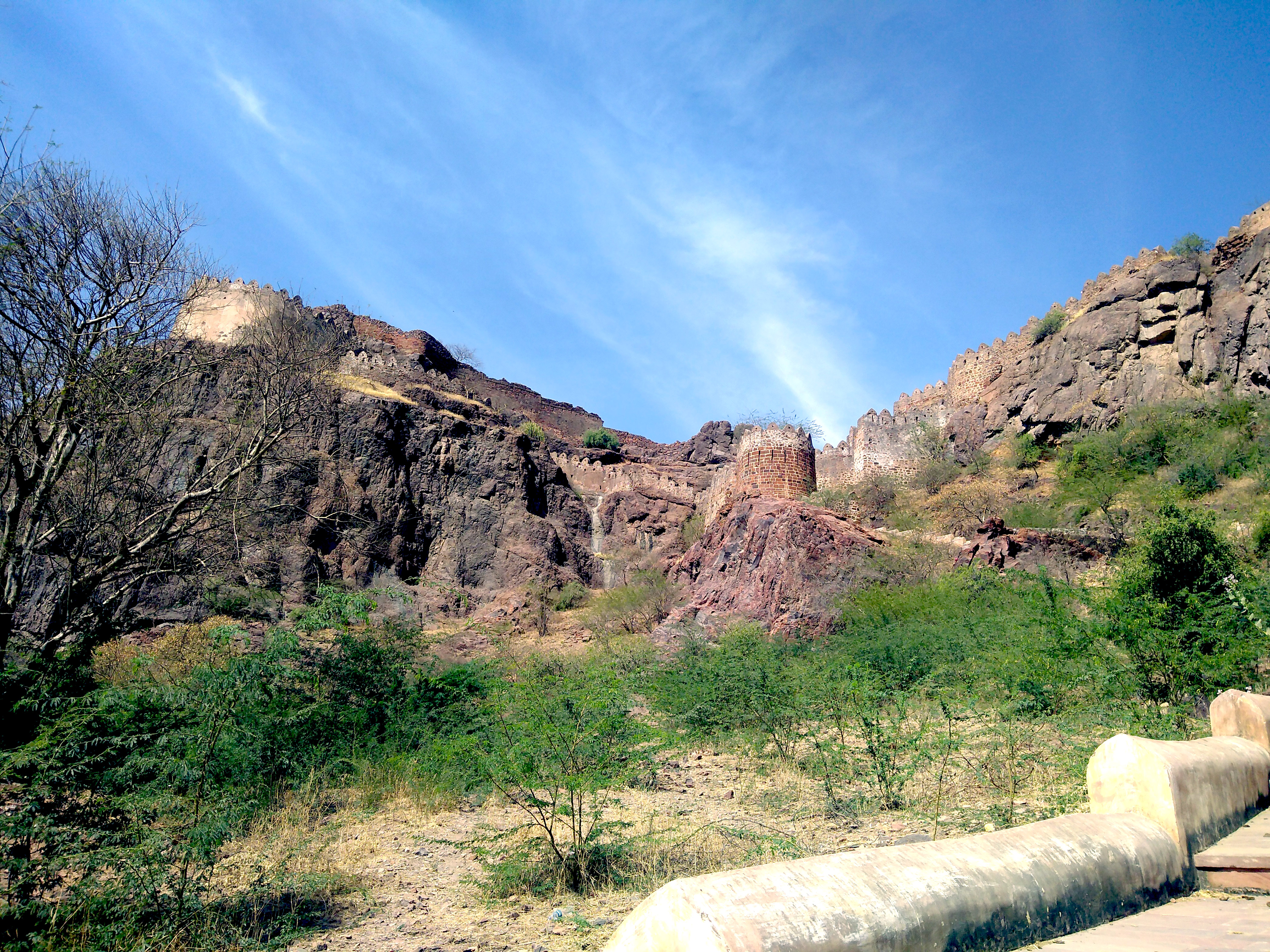
English: Fort of Siwana, also known as Gadh Siwana is a fort atop a cliff in the city of Siwana in Barmer district. Not much of the fort remains, however, one can still see the fort boundary which adorns the outer periphery of the cliff. Once, you manage to climb the one set of steps, you can see a waterbody atop the hill. For the rest of the climb inside the complex, there are no steps remaining, and one has to climb up the terrain to see the rest of it.
|
||
| Date | |||
| Source | Own work | ||
| Author | Akshita raina |
| Camera location | 25° 39′ 03.5″ N, 72° 24′ 57.5″ E | View this and other nearby images on: OpenStreetMap |
|---|
Licensing
- You are free:
- to share – to copy, distribute and transmit the work
- to remix – to adapt the work
- Under the following conditions:
- attribution – You must give appropriate credit, provide a link to the license, and indicate if changes were made. You may do so in any reasonable manner, but not in any way that suggests the licensor endorses you or your use.
- share alike – If you remix, transform, or build upon the material, you must distribute your contributions under the same or compatible license as the original.

|
This image was uploaded as part of Wiki Loves Monuments 2019.
Afrikaans ∙ Alemannisch ∙ azərbaycanca ∙ Bahasa Indonesia ∙ Bahasa Melayu ∙ Bikol Central ∙ bosanski ∙ brezhoneg ∙ català ∙ čeština ∙ Cymraeg ∙ dansk ∙ davvisámegiella ∙ Deutsch ∙ eesti ∙ English ∙ español ∙ Esperanto ∙ euskara ∙ français ∙ Frysk ∙ Gaeilge ∙ galego ∙ hrvatski ∙ Ido ∙ italiano ∙ latviešu ∙ Lëtzebuergesch ∙ Malagasy ∙ magyar ∙ Malti ∙ Nederlands ∙ norsk ∙ norsk nynorsk ∙ norsk bokmål ∙ polski ∙ português ∙ português do Brasil ∙ română ∙ shqip ∙ sicilianu ∙ slovenčina ∙ slovenščina ∙ suomi ∙ svenska ∙ Tagalog ∙ Türkçe ∙ Yorùbá ∙ Zazaki ∙ Ελληνικά ∙ беларуская ∙ беларуская (тарашкевіца) ∙ български ∙ кыргызча ∙ македонски ∙ русский ∙ српски / srpski ∙ українська ∙ ქართული ∙ հայերեն ∙ नेपाली ∙ हिन्दी ∙ বাংলা ∙ മലയാളം ∙ ไทย ∙ 한국어 ∙ +/− |
 |
Captions
Items portrayed in this file
depicts
26 February 2018
25°39'3.499"N, 72°24'57.499"E
File history
Click on a date/time to view the file as it appeared at that time.
| Date/Time | Thumbnail | Dimensions | User | Comment | |
|---|---|---|---|---|---|
| current | 16:23, 7 September 2019 | | 4,160 × 3,120 (4.64 MB) | Akshitaraina | User created page with UploadWizard |
File usage
Global file usage
The following other wikis use this file:
- Usage on te.wikipedia.org
- Usage on www.wikidata.org
Metadata
This file contains additional information, probably added from the digital camera or scanner used to create or digitize it.
If the file has been modified from its original state, some details may not fully reflect the modified file.
| Camera manufacturer | motorola |
|---|---|
| Camera model | Moto G (5S) Plus |
| Exposure time | 1/1,204 sec (0.00083056478405316) |
| F-number | f/2 |
| ISO speed rating | 100 |
| Date and time of data generation | 11:27, 26 February 2018 |
| Lens focal length | 3.59 mm |
| Width | 4,160 px |
| Height | 3,120 px |
| Bits per component |
|
| Pixel composition | RGB |
| Orientation | Normal |
| Number of components | 3 |
| Horizontal resolution | 72 dpi |
| Vertical resolution | 72 dpi |
| Software used | Adobe Photoshop CS6 (Windows) |
| File change date and time | 01:14, 7 September 2019 |
| Y and C positioning | Centered |
| Exposure Program | Normal program |
| Exif version | 2.2 |
| Date and time of digitizing | 11:27, 26 February 2018 |
| Meaning of each component |
|
| Shutter speed | 10.233 |
| APEX aperture | 2 |
| APEX brightness | 0 |
| Exposure bias | 0 |
| Maximum land aperture | 2 APEX (f/2) |
| Metering mode | Center weighted average |
| Flash | Flash did not fire, compulsory flash suppression |
| DateTime subseconds | 512535 |
| DateTimeOriginal subseconds | 512535 |
| DateTimeDigitized subseconds | 512535 |
| Supported Flashpix version | 1 |
| Color space | sRGB |
| Scene type | 0 |
| Custom image processing | Normal process |
| Exposure mode | Auto exposure |
| White balance | Auto white balance |
| Digital zoom ratio | 1 |
| Scene capture type | Standard |
| Geodetic survey data used | WGS-84 |
| GPS tag version | 2.2.0.0 |
| Date metadata was last modified | 06:44, 7 September 2019 |
| Unique ID of original document | 7BB071E2AB03447D56A4B83D654F6855 |
| IIM version | 2,047 |