File:A947-map.png
From Wikipedia, the free encyclopedia
Size of this preview: 682 × 600 pixels. Other resolutions: 273 × 240 pixels | 546 × 480 pixels | 873 × 768 pixels | 1,164 × 1,024 pixels | 2,000 × 1,759 pixels.
Original file (2,000 × 1,759 pixels, file size: 852 KB, MIME type: image/png)
| This is a file from the Wikimedia Commons. Information from its description page there is shown below. Commons is a freely licensed media file repository. You can help. |
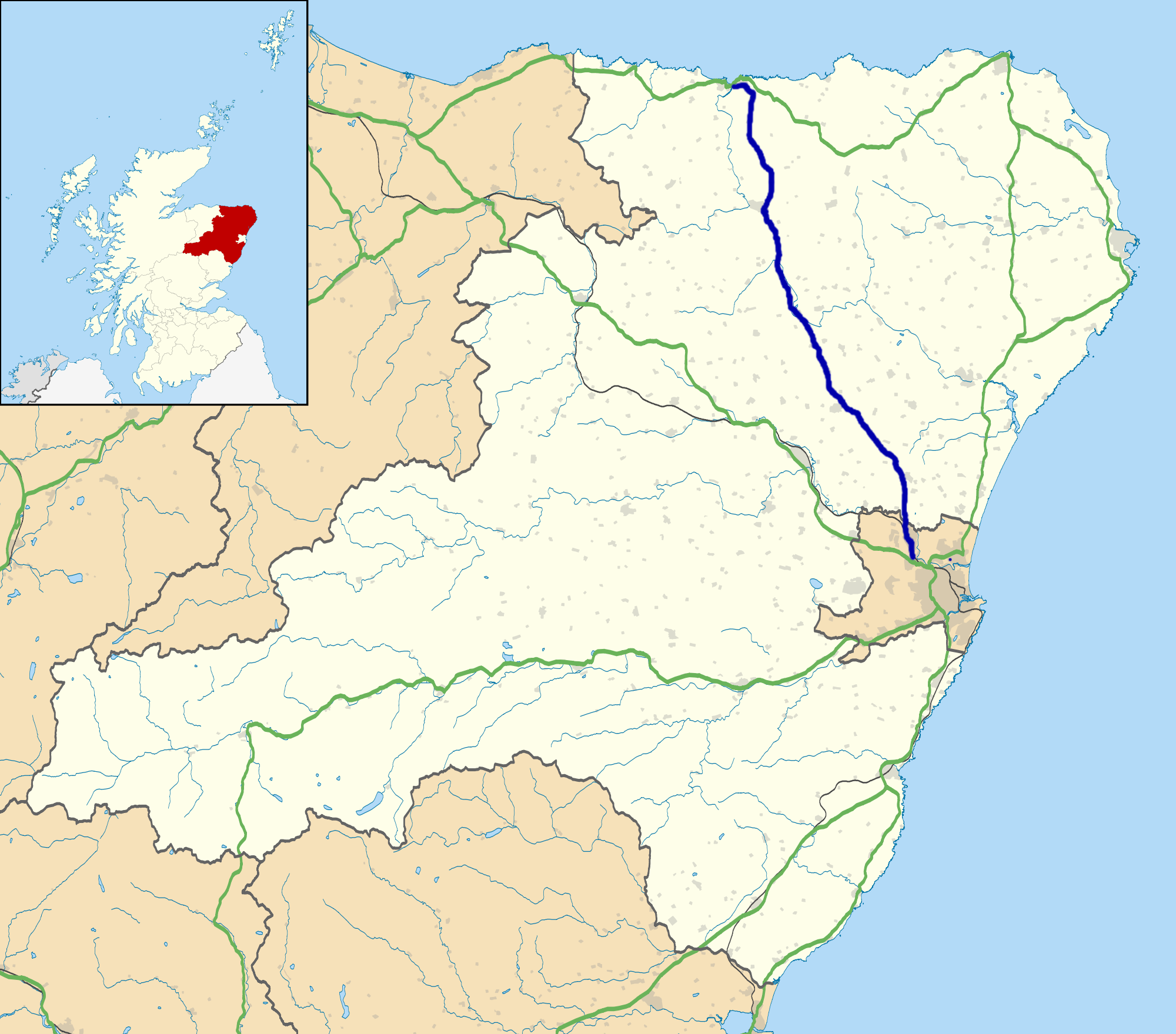
| DescriptionA947-map.png | A947 road map |
| Date | 18.1.14 |
| Source |
|
| Author | Eschenmoser |
| Permission (Reusing this file) |
This file is licensed under the Creative Commons Attribution-Share Alike 3.0 Unported license. Attribution: Contains Ordnance Survey data © Crown copyright and database right
|
Captions
Add a one-line explanation of what this file represents
Items portrayed in this file
depicts
image/png
5f5748cc3713d22bb4c2cce252be9d65fb3b4df7
872,444 byte
1,759 pixel
2,000 pixel
File history
Click on a date/time to view the file as it appeared at that time.
| Date/Time | Thumbnail | Dimensions | User | Comment | |
|---|---|---|---|---|---|
| current | 11:52, 18 January 2014 | | 2,000 × 1,759 (852 KB) | Eschenmoser | {{Information |Description=A947 road map |Source=* own work derived from File:Aberdeenshire UK location map.svg originally uploaded by User:Nilfanion, created using Ordnance Survey data *Ordnance Survey [https://www.ordna... |
File usage
The following pages on the English Wikipedia use this file (pages on other projects are not listed):
Global file usage
The following other wikis use this file:
Metadata
This file contains additional information, probably added from the digital camera or scanner used to create or digitize it.
If the file has been modified from its original state, some details may not fully reflect the modified file.
| Horizontal resolution | 28.35 dpc |
|---|---|
| Vertical resolution | 28.35 dpc |
| File change date and time | 10:44, 18 January 2014 |
Retrieved from "https://en.wikipedia.org/wiki/File:A947-map.png"