File:Tawi-Tawi_blank_map.PNG
From Wikipedia, the free encyclopedia
No higher resolution available.
Tawi-Tawi_blank_map.PNG (300 × 250 pixels, file size: 8 KB, MIME type: image/png)
| This is a file from the Wikimedia Commons. Information from its description page there is shown below. Commons is a freely licensed media file repository. You can help. |
| DescriptionTawi-Tawi blank map.PNG |
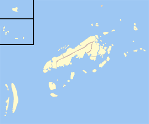
English: Blank Map of Tawi-Tawi |
| Date | (UTC) |
| Source | |
| Author |
|
| This is a retouched picture, which means that it has been digitally altered from its original version. Modifications: retouched, removed colors to make a blank map. The original can be viewed here: Ph locator tawi-tawi panglima sugala.png:
|
I, the copyright holder of this work, hereby publish it under the following licenses:
This file is licensed under the Creative Commons Attribution-Share Alike 3.0 Unported license.
- You are free:
- to share – to copy, distribute and transmit the work
- to remix – to adapt the work
- Under the following conditions:
- attribution – You must give appropriate credit, provide a link to the license, and indicate if changes were made. You may do so in any reasonable manner, but not in any way that suggests the licensor endorses you or your use.
- share alike – If you remix, transform, or build upon the material, you must distribute your contributions under the same or compatible license as the original.

|
Permission is granted to copy, distribute and/or modify this document under the terms of the GNU Free Documentation License, Version 1.2 or any later version published by the Free Software Foundation; with no Invariant Sections, no Front-Cover Texts, and no Back-Cover Texts. A copy of the license is included in the section entitled GNU Free Documentation License.http://www.gnu.org/copyleft/fdl.htmlGFDLGNU Free Documentation Licensetruetrue |
You may select the license of your choice.
Original upload log
This image is a derivative work of the following images:
- File:Ph_locator_tawi-tawi_panglima_sugala.png licensed with Cc-by-sa-3.0, GFDL
- 2006-01-01T13:01:20Z Magalhães 300x250 (7100 Bytes) Map of Tawi-Tawi showing the location of __. Created by TheCoffee. Released under the [[GNU FDL]] {{GFDL-en}} [[Category:Maps of Tawi-Tawi]]
Uploaded with derivativeFX
Captions
Add a one-line explanation of what this file represents
Items portrayed in this file
depicts
30 December 2009
File history
Click on a date/time to view the file as it appeared at that time.
| Date/Time | Thumbnail | Dimensions | User | Comment | |
|---|---|---|---|---|---|
| current | 14:42, 30 December 2009 | | 300 × 250 (8 KB) | JL 09 | Added locator for a municipality, which was not included before. |
| 14:37, 30 December 2009 |  | 300 × 250 (7 KB) | JL 09 | {{Information |Description={{en|1=Blank Map of Tawi-Tawi}} |Source=*File:Ph_locator_tawi-tawi_panglima_sugala.png |Date=2009-12-30 14:36 (UTC) |Author=*File:Ph_locator_tawi-tawi_panglima_sugala.png: Mike Gonzalez (TheCoffee) |
File usage
The following pages on the English Wikipedia use this file (pages on other projects are not listed):
Global file usage
The following other wikis use this file:
- Usage on bcl.wikipedia.org
- Usage on tl.wikipedia.org
Retrieved from "https://en.wikipedia.org/wiki/File:Tawi-Tawi_blank_map.PNG"