File:Romagna_geopolitica.png
From Wikipedia, the free encyclopedia
No higher resolution available.
Romagna_geopolitica.png (608 × 516 pixels, file size: 240 KB, MIME type: image/png)
| This is a file from the Wikimedia Commons. Information from its description page there is shown below. Commons is a freely licensed media file repository. You can help. |
Summary
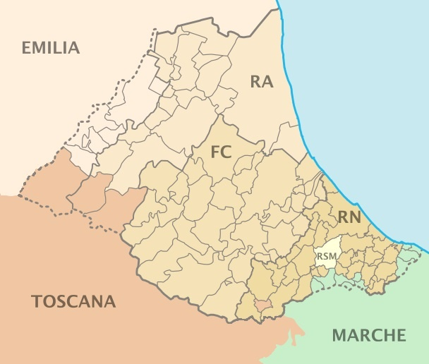
| DescriptionRomagna geopolitica.png |
English: Map of Romagna (Italy) |
| Date | |
| Source | Derivative work from OpenStreetMap, released with CC-BY-SA-2.0 license |
| Author | User:Erinaceus |
| Other versions |
Derivative works of this file: Location map of Romagna.svg: |
Licensing
This file is licensed under the Creative Commons Attribution-Share Alike 2.0 Generic license.
- You are free:
- to share – to copy, distribute and transmit the work
- to remix – to adapt the work
- Under the following conditions:
- attribution – You must give appropriate credit, provide a link to the license, and indicate if changes were made. You may do so in any reasonable manner, but not in any way that suggests the licensor endorses you or your use.
- share alike – If you remix, transform, or build upon the material, you must distribute your contributions under the same or compatible license as the original.
Captions
Add a one-line explanation of what this file represents
Items portrayed in this file
depicts
5 June 2011
image/png
File history
Click on a date/time to view the file as it appeared at that time.
| Date/Time | Thumbnail | Dimensions | User | Comment | |
|---|---|---|---|---|---|
| current | 20:25, 6 January 2022 | | 608 × 516 (240 KB) | Sentruper | Exclusion of the sources of Idice, Savena and Setta. |
| 16:24, 30 September 2021 |  | 608 × 516 (116 KB) | Sentruper | Badia Tedalda and Sestino are not part of Romagna | |
| 08:20, 29 June 2021 |  | 608 × 516 (110 KB) | Krepideia | Aggregation of Montecopiolo and Sassofeltrio to region Emilia Romagna | |
| 12:07, 5 June 2011 |  | 608 × 516 (115 KB) | Actormusicus |
File usage
The following pages on the English Wikipedia use this file (pages on other projects are not listed):
Global file usage
The following other wikis use this file:
- Usage on bg.wikipedia.org
- Usage on br.wikipedia.org
- Usage on cs.wikipedia.org
- Usage on es.wikipedia.org
- Usage on et.wikipedia.org
- Usage on eu.wikipedia.org
- Usage on fr.wikipedia.org
- Usage on he.wikipedia.org
- Usage on hr.wikipedia.org
- Usage on hu.wikipedia.org
- Usage on it.wikipedia.org
- Usage on ja.wikipedia.org
- Usage on ko.wikipedia.org
- Usage on la.wikipedia.org
- Usage on nl.wikipedia.org
- Usage on no.wikipedia.org
- Usage on pt.wikipedia.org
- Usage on ro.wikipedia.org
- Usage on sr.wikipedia.org
- Usage on sv.wikipedia.org
- Usage on tr.wikipedia.org
- Usage on vec.wikipedia.org
- Usage on www.wikidata.org
- Usage on zh.wikipedia.org
Metadata
This file contains additional information, probably added from the digital camera or scanner used to create or digitize it.
If the file has been modified from its original state, some details may not fully reflect the modified file.
| Horizontal resolution | 37.79 dpc |
|---|---|
| Vertical resolution | 37.79 dpc |
Retrieved from "https://en.wikipedia.org/wiki/File:Romagna_geopolitica.png"