File:Lake_Pontchartrain.png
From Wikipedia, the free encyclopedia
Size of this preview: 800 × 494 pixels. Other resolutions: 320 × 198 pixels | 640 × 395 pixels | 889 × 549 pixels.
Original file (889 × 549 pixels, file size: 42 KB, MIME type: image/png)
| This is a file from the Wikimedia Commons. Information from its description page there is shown below. Commons is a freely licensed media file repository. You can help. |
Summary
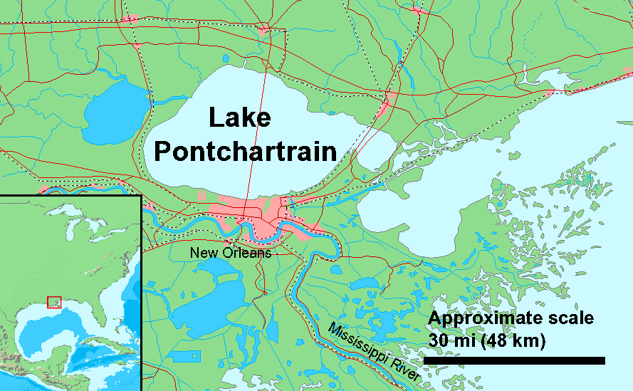
Lake Pontchartrain, Louisiana, USA
Quick map for Hurricane Katrina, needs work
Derived from Demi Public Domain Map Server[dead link], Public Domain data sources used archive copy at the Wayback Machine
Licensing
I, the copyright holder of this work, hereby publish it under the following license:

|
Permission is granted to copy, distribute and/or modify this document under the terms of the GNU Free Documentation License, Version 1.2 or any later version published by the Free Software Foundation; with no Invariant Sections, no Front-Cover Texts, and no Back-Cover Texts. A copy of the license is included in the section entitled GNU Free Documentation License.http://www.gnu.org/copyleft/fdl.htmlGFDLGNU Free Documentation Licensetruetrue |
| This file is licensed under the Creative Commons Attribution-Share Alike 3.0 Unported license. | ||
| ||
| This licensing tag was added to this file as part of the GFDL licensing update.http://creativecommons.org/licenses/by-sa/3.0/CC BY-SA 3.0Creative Commons Attribution-Share Alike 3.0truetrue |
Captions
Add a one-line explanation of what this file represents
Items portrayed in this file
depicts
File history
Click on a date/time to view the file as it appeared at that time.
| Date/Time | Thumbnail | Dimensions | User | Comment | |
|---|---|---|---|---|---|
| current | 17:06, 29 November 2005 | | 889 × 549 (42 KB) | Duk | updated with causway |
| 18:01, 30 August 2005 |  | 889 × 549 (41 KB) | Duk | rm demi watermark | |
| 17:47, 30 August 2005 |  | 889 × 549 (41 KB) | Duk | Lake Pontcharin, Louisiana, USA Quick map for Hurricane Katrina, needs work Derived from [http://www2.demis.nl/mapserver/mapper.asp Demi Public Domain Map Server], [http://www2.demis.nl/mapserver/DataSrc.htm Public Domain data sources used] |
File usage
The following pages on the English Wikipedia use this file (pages on other projects are not listed):
Global file usage
The following other wikis use this file:
- Usage on af.wikipedia.org
- Usage on als.wikipedia.org
- Usage on ca.wikipedia.org
- Usage on de.wikipedia.org
- Usage on es.wikipedia.org
- Usage on fa.wikipedia.org
- Usage on fi.wikipedia.org
- Usage on frr.wikipedia.org
- Usage on fr.wikipedia.org
- Usage on id.wikipedia.org
- Usage on io.wikipedia.org
- Usage on it.wikipedia.org
- Usage on ja.wikipedia.org
- Usage on nl.wikipedia.org
- Usage on pl.wikipedia.org
- Usage on pt.wikipedia.org
- Usage on simple.wikipedia.org
- Usage on sw.wikipedia.org
- Usage on zh.wikipedia.org
Retrieved from "https://en.wikipedia.org/wiki/File:Lake_Pontchartrain.png"