File:Malvern_Hills_-_England.jpg
From Wikipedia, the free encyclopedia
Original file (3,656 × 2,119 pixels, file size: 2.41 MB, MIME type: image/jpeg)
| This is a file from the Wikimedia Commons. Information from its description page there is shown below. Commons is a freely licensed media file repository. You can help. |
Summary
| DescriptionMalvern Hills - England.jpg |
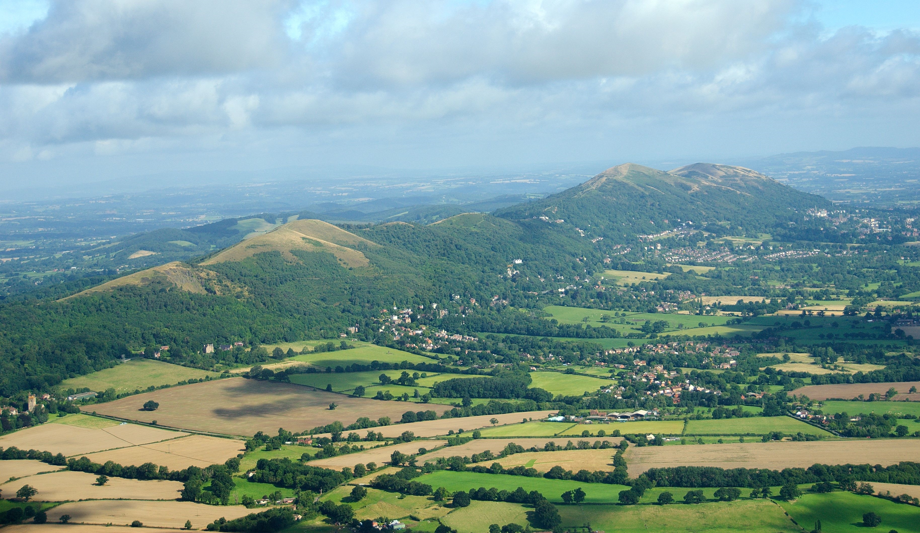
English: The Malvern Hills located in the English counties of Worcestershire and Herefordshire. The hills have been designated by the Countryside Agency as an Area of Outstanding Natural Beauty. The highest point is the Worcestershire Beacon at 425 metres (1,394 ft) above sea level. The range is a natural border between Worcestershire and Herefordshire. |
| Date | |
| Source |
https://www.flickr.com/photos/davidchief/2765256316/
|
| Author | David Martyn Hunt |
| Camera location | 52° 03′ 48.86″ N, 2° 19′ 42.91″ W | View this and other nearby images on: OpenStreetMap |
|---|
Licensing
| This image, originally posted to Flickr, was reviewed on 4 March 2012 by the administrator or reviewer Materialscientist, who confirmed that it was available on Flickr under the stated license on that date. |
- You are free:
- to share – to copy, distribute and transmit the work
- to remix – to adapt the work
- Under the following conditions:
- attribution – You must give appropriate credit, provide a link to the license, and indicate if changes were made. You may do so in any reasonable manner, but not in any way that suggests the licensor endorses you or your use.
| Annotations InfoField | This image is annotated: View the annotations at Commons |
Worcestershire Beacon with its 425 m (1,395 ft) is the highest point of the range.
Upper Welland settlement
Malvern Wells village
Worcestershire Golf Club
Malvern town

|
This image has been assessed under the valued image criteria and is considered the most valued image on Commons within the scope: Malvern Hills, England. You can see its nomination here. |
Captions
Items portrayed in this file
depicts
some value
4 March 2012
52°3'48.859"N, 2°19'42.910"W
0.00200000032782554626 second
4.80000019073486328125
50 millimetre
image/jpeg
File history
Click on a date/time to view the file as it appeared at that time.
| Date/Time | Thumbnail | Dimensions | User | Comment | |
|---|---|---|---|---|---|
| current | 16:41, 24 April 2023 | | 3,656 × 2,119 (2.41 MB) | Artanisen | Highest quality (same source) |
| 12:53, 4 March 2012 |  | 1,003 × 577 (603 KB) | MrPanyGoff | cropped blown clouds | |
| 12:35, 4 March 2012 |  | 1,003 × 658 (635 KB) | MrPanyGoff |
File usage
Global file usage
The following other wikis use this file:
- Usage on arz.wikipedia.org
- Usage on ceb.wikipedia.org
- Usage on de.wikipedia.org
- Usage on de.wikivoyage.org
- Usage on en.wikivoyage.org
- Usage on fa.wikipedia.org
- Usage on fr.wikipedia.org
- Usage on he.wikipedia.org
- Usage on io.wikipedia.org
- Usage on is.wikipedia.org
- Usage on it.wikivoyage.org
- Usage on mg.wikipedia.org
- Usage on pl.wikipedia.org
- Usage on tr.wikipedia.org
- Usage on www.wikidata.org
- Usage on zh.wikipedia.org
Metadata
This file contains additional information, probably added from the digital camera or scanner used to create or digitize it.
If the file has been modified from its original state, some details may not fully reflect the modified file.
| Exposure time | 536,871/268,435,456 sec (0.0020000003278255) |
|---|---|
| F-number | f/4.8000001907349 |
| Lens focal length | 50 mm |
| Orientation | Normal |
| Horizontal resolution | 300 dpi |
| Vertical resolution | 300 dpi |
| File change date and time | 09:48, 14 August 2008 |
| Shutter speed | 8.965784072876 |
| APEX aperture | 4.5260691642761 |
| Exposure bias | 0 |
| Maximum land aperture | 3.614709854126 APEX (f/3.5) |
| DateTime subseconds | 3 |
| Scene type | A directly photographed image |
| Exposure mode | Auto exposure |
| Scene capture type | Standard |
| Subject distance range | Unknown |
| GPS tag version | 0.3.0.0 |
| Urgency | 0 |
| IIM version | 4 |