File:Catrine_station_geograph-3299422-by-Ben-Brooksbank.jpg
From Wikipedia, the free encyclopedia
Size of this preview: 800 × 476 pixels. Other resolutions: 320 × 190 pixels | 640 × 381 pixels | 1,024 × 609 pixels | 1,280 × 761 pixels | 2,433 × 1,447 pixels.
Original file (2,433 × 1,447 pixels, file size: 752 KB, MIME type: image/jpeg)
| This is a file from the Wikimedia Commons. Information from its description page there is shown below. Commons is a freely licensed media file repository. You can help. |
Summary
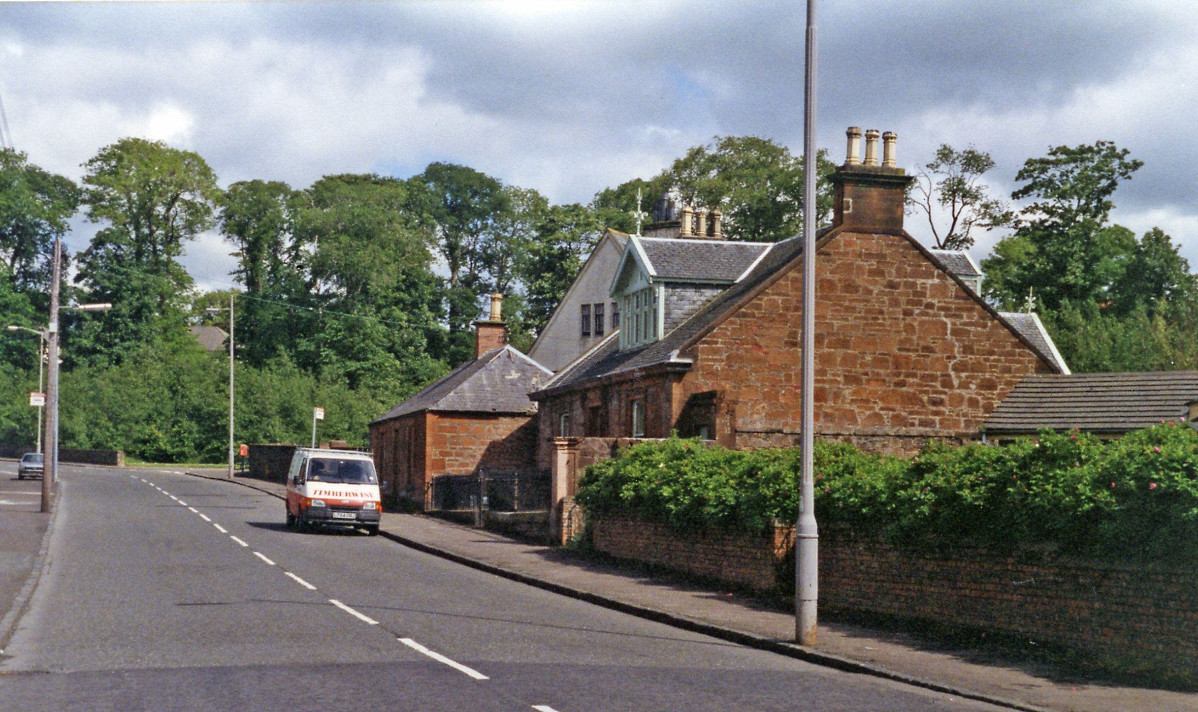
| DescriptionCatrine station geograph-3299422-by-Ben-Brooksbank.jpg |
English: Site of Catrine station. View northward, terminus to the right, Mauchline to the left: ex-GSWR branch from Mauchline, closed for passengers 3/5/43, for goods 6/7/64. [The station was somewhre very near here!]. |
| Date | |
| Source | From geograph.org.uk |
| Author | Ben Brooksbank |
| Permission (Reusing this file) |
Creative Commons Attribution Share-alike license 2.0 |
| Attribution (required by the license) InfoField | Ben Brooksbank / Site of Catrine station / |
InfoField | Ben Brooksbank / Site of Catrine station |
| Camera location | 55° 30′ 10.65″ N, 4° 19′ 48.68″ W | View this and other nearby images on: OpenStreetMap |
|---|
Licensing

|
This image was taken from the Geograph project collection. See this photograph's page on the Geograph website for the photographer's contact details. The copyright on this image is owned by Ben Brooksbank and is licensed for reuse under the Creative Commons Attribution-ShareAlike 2.0 license.
|
This file is licensed under the Creative Commons Attribution-Share Alike 2.0 Generic license.
Attribution: Ben Brooksbank
- You are free:
- to share – to copy, distribute and transmit the work
- to remix – to adapt the work
- Under the following conditions:
- attribution – You must give appropriate credit, provide a link to the license, and indicate if changes were made. You may do so in any reasonable manner, but not in any way that suggests the licensor endorses you or your use.
- share alike – If you remix, transform, or build upon the material, you must distribute your contributions under the same or compatible license as the original.
Captions
Add a one-line explanation of what this file represents
Items portrayed in this file
depicts
some value
21 June 1994
55°30'10.652"N, 4°19'48.680"W
image/jpeg
793616415499396d1ab44b2ebd4950f33903ff3c
769,595 byte
1,447 pixel
2,433 pixel
File history
Click on a date/time to view the file as it appeared at that time.
| Date/Time | Thumbnail | Dimensions | User | Comment | |
|---|---|---|---|---|---|
| current | 15:10, 12 February 2013 | | 2,433 × 1,447 (752 KB) | Chevin | == {{int:filedesc}} == {{Information |Description={{en|1='''Site of Catrine station.'''<br/> View northward, terminus to the right, Mauchline to the left: ex-GSWR branch from Mauchline, closed for passengers 3/5/43, for goods 6/7/64. [The station was s... |
File usage
The following pages on the English Wikipedia use this file (pages on other projects are not listed):
Global file usage
The following other wikis use this file:
- Usage on www.wikidata.org