File:Arizona_Tribal_Lands.png
From Wikipedia, the free encyclopedia
Size of this preview: 463 × 599 pixels. Other resolutions: 185 × 240 pixels | 371 × 480 pixels | 593 × 768 pixels | 791 × 1,024 pixels | 1,836 × 2,376 pixels.
Original file (1,836 × 2,376 pixels, file size: 378 KB, MIME type: image/png)
| This is a file from the Wikimedia Commons. Information from its description page there is shown below. Commons is a freely licensed media file repository. You can help. |
Summary
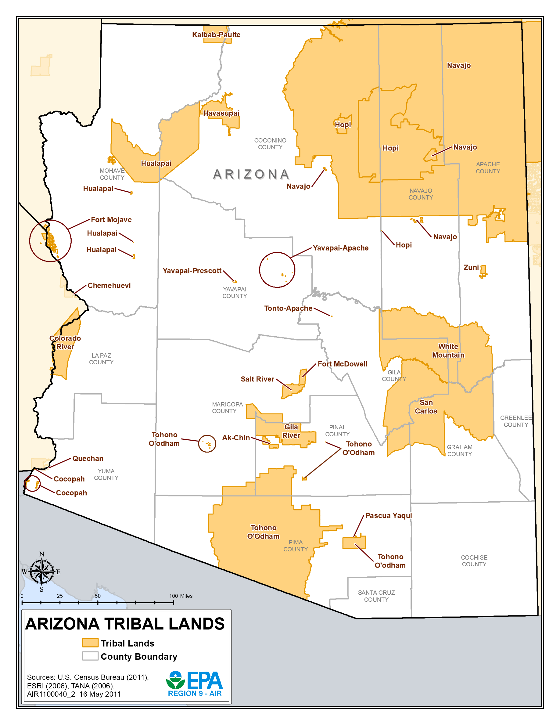
| DescriptionArizona Tribal Lands.png |
English: Map of Indian Reservations in Arizona |
| Date | |
| Source |
USEPA Air Quality Analysis Maps, "Arizona Tribal Lands," 16 May 2011, retrieved 24 Aug 2015 http://www.epa.gov/region9/air/maps/az_tribe.html Sources: U.S. Census Bureau (2011), Environmental Systems Research Institute (2006), Technical Assistance Needs Assessment (2006) |
| Author | United States Environmental Protection Agency |
Licensing
| Public domainPublic domainfalsefalse |
This image (or other media) is a work of an Environmental Protection Agency employee, taken or made as part of that person's official duties. As works of the U.S. federal government, all EPA images are in the public domain.
|
||
| العربية ∙ Deutsch ∙ English ∙ eesti ∙ italiano ∙ 日本語 ∙ македонски ∙ Nederlands ∙ polski ∙ português ∙ sicilianu ∙ slovenščina ∙ ไทย ∙ українська ∙ 简体中文 ∙ 繁體中文 ∙ +/− |
Captions
Add a one-line explanation of what this file represents
Items portrayed in this file
depicts
16 May 2011
image/png
c887427bdb4b7ba4493554ba17fac09d35b29ce2
386,616 byte
2,376 pixel
1,836 pixel
File history
Click on a date/time to view the file as it appeared at that time.
| Date/Time | Thumbnail | Dimensions | User | Comment | |
|---|---|---|---|---|---|
| current | 18:54, 24 August 2015 | | 1,836 × 2,376 (378 KB) | Sumiaz | User created page with UploadWizard |
File usage
The following pages on the English Wikipedia use this file (pages on other projects are not listed):
Global file usage
The following other wikis use this file:
- Usage on fr.wikipedia.org
- Usage on ru.wikipedia.org
Metadata
This file contains additional information, probably added from the digital camera or scanner used to create or digitize it.
If the file has been modified from its original state, some details may not fully reflect the modified file.
| Horizontal resolution | 56.69 dpc |
|---|---|
| Vertical resolution | 56.69 dpc |
Retrieved from "https://en.wikipedia.org/wiki/File:Arizona_Tribal_Lands.png"